Weather warnings for snow and ice across Northern Ireland as drivers are told to exercise caution
and live on Freeview channel 276
A PSNI spokeswoman said: "Reduce your speed, and increase your stopping distance from the vehicle in front."
It came as the UK Met Office issued a snow and ice warning for Northern Ireland between 3am on Monday until 9am on Tuesday.
Advertisement
Hide AdAdvertisement
Hide AdIt said snow showers would bring some disruption, warning the public to expect that some roads and railways are likely to be affected with longer journey times on services.
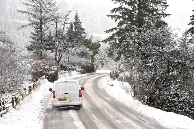

The forecaster said there will probably be some injuries from slips and falls on icy surfaces such as untreated roads, pavements and cycle paths.
A separate yellow-level snow warning will come into effect for the north-most parts of the region for all of Wednesday and Thursday. It applies to counties Antrim, Londonderry and Tyrone.
Wednesday and Thursday’s warning applies to southwest Scotland, Northern Ireland, northwest England and Wales.
Advertisement
Hide AdAdvertisement
Hide AdThe forecaster said snow showers are likely to continue during Wednesday night and well into Thursday, with 2-5 cm of snow expected in many places and a chance that some low-lying areas could see 10 cm in a few hours.
The Met Office warns that the conditions may cause delays and make driving conditions dangerous.
It urges drivers to plan their routes, allow time for delays and to pack the following in case of delays on the roads;- warm clothing, food, water, a blanket, a torch, ice scraper/de-icer, a warning triangle, high visibility vest and an in-car phone charger).
For Monday and Tuesday, it says brisk northerly winds are expected to drive showers well inland with these initially falling as snow over higher ground and sleet and rain elsewhere.
Advertisement
Hide AdAdvertisement
Hide Ad"However, as increasingly cold air spreads south, showers will fall as snow to all levels by late morning,” warned the Met Office. “Up to 5 cm of snow is likely over higher routes such as the Coleraine Mountain road and Glenshane Pass.
"At lower levels, a few cms can be expected, with northern counties expected to see the more frequent showers. Ice will be an additional hazard for all areas into the evening."
Weather warnings were also put in place across the south of Ireland amid plummeting temperatures of -4C in parts.
The Republic of Ireland's national weather agency has said it will be very cold overnight on Sunday and into early Monday morning with the danger of icy patches and some freezing fog.
Advertisement
Hide AdAdvertisement
Hide AdMet Eireann issued a status yellow low temperature and ice warning for every county, cautioning the public that there will be some sleet and snow showers in places.
The warnings were due to come into effect from 7pm on Sunday until 11am on Monday.
Met Eireann advised that lowest temperatures overnight will be between -3 and +1 degrees, possibly colder in the midlands.
Temperatures are forecast to drop further to -4c in parts on Monday and Tuesday night.